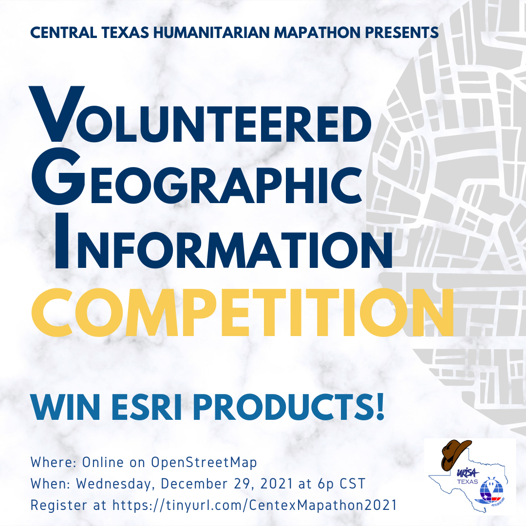
Central Texas Humanitarian Mapathons and ATX GIS Day - URISA Texas Presents a
Holiday Volunteered Geographic Information (VGI) Competition
Location: Zoom
Topic:
OpenStreetMap
OpenStreetMap is an opensource community using aerial imagery. Our topic for the month will be based on need. We will evaluate what is needed in the community prior to the event.
OpenStreetMap is built by a community of mappers that contribute and maintain data about roads, trails, cafés, railway stations, and much more, all over the world.
Local Knowledge - OpenStreetMap emphasizes local knowledge. Contributors use aerial imagery, GPS devices, and low-tech field maps to verify that OSM is accurate and up to date.
Community Driven - OpenStreetMap's community is diverse, passionate, and growing every day. Our contributors include enthusiast mappers, GIS professionals, engineers running the OSM servers, humanitarians mapping disaster-affected areas, and many more.
Open Data - OpenStreetMap is open data: you are free to use it for any purpose as long as you credit OpenStreetMap and its contributors. If you alter or build upon the data in certain ways, you may distribute the result only under the same license.
Prize
Great prizes will be awarded to winners. Participants earn an opportunity to win free Esri products sponsored by Esri.
Lucky participants will be selected at random. Each winner will receive an ArcGIS for Personal Use license valued at $100 and includes access to:
- ArcGIS Desktop Advanced - One Single Use License
- ArcGIS 3D Analyst
- ArcGIS Data Interoperability
- ArcGIS Data Reviewer
- ArcGIS Geostatistical Analyst
- ArcGIS Image Analyst for Pro
- ArcGIS Network Analyst
- ArcGIS Publisher
- ArcGIS Schematics
- ArcGIS Spatial Analyst
- ArcGIS Tracking Analyst
- ArcGIS Workflow Manager
- ArcGIS Online: One Named User Entitlement and 100 Service Credits
Moderators: Katherine Strickland
About the Moderators:
 Katherine Strickland is the University of Texas at Austin, UT Libraries' Maps Coordinator. In this position, I am responsible for all aspects of collection development, liaison, public, and digital scholarship services related to maps. I have worked for the UT Libraries for over 20 years, and I began working in the PCL Map Collection in 2009. I did not have a geography or GIS background before working with the Map Collection. I first managed the PCL Map Room, cataloged cartographic materials, and learned GIS to help UT patrons before the UT Libraries hired GIS experts. I have created numerous maps published in books and articles, as well as a basemap for an exhibition in the Bob Bullock Story of Texas Museum!
ZOOM Link in Confirmation and Reminder Emails
What to do before the event:
More information can be found here:
https://www.hotosm.org/what-we-do
https://www.missingmaps.org/
https://www.giscorps.org/hot-projects/
For future notifications regarding OSM Mapathons you can sign up here:
https://tinyurl.com/atxmapathon
Audience:
This meetup is open to all ages and abilities. This recurring event is welcoming and respectful to everyone. Novices and experts are welcome. There are tasks for all levels of experience.
See you there!